
Language of Presentation: English
Media Format: Streaming Video, Webpage
School Level: College/University, Middle/High School
Institution/Provider: Vox
Author: Max Fisher
Collection:
Condition of Use: Fair Use for Education Description:
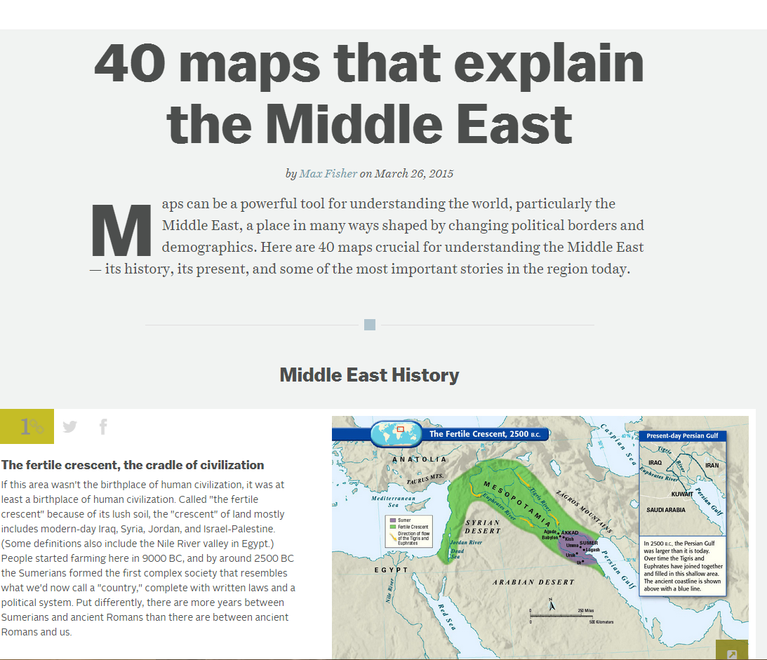
This is a collection of maps seeking to “explain” the Middle East. Maps run the gamut from historical maps revealing plans to break up the Ottoman empire to detailed mapping of ethnic groups in the Middle East. Teachers can allow students to read the paragraph interpreting each map, or click on the map to isolate the image and encourage students to perform their own analysis. These maps can also be used to demonstrate what we can learn from maps in terms of not just physical but also human geography. >
أتوقع الاستفاده منها والتعرف على المناطق وطبيعه البيئة
Very nice information. Thank you so much for sharing. I was looking for such a website to share with my students. You saved me a lot of time.
Maps can be used as visuals to enhance comprehension.